Projects
PhD trajectories
1) The Impact of Historical Air Pollution on Dutch Cities 1850-1950 – by Catherine Simpson (2023-2027)
In this PhD project, the central question is how air pollution impacts health and other wellbeing outcomes in Dutch cities during a time of rapid technological change and economic growth (c. 1850-1950). Using GIS techniques, we can estimate exposure to air pollution and create a dataset that accounts for individual cofounders. The resulting dataset will be analyzed using regression analysis. The individual-level data allows us to control for several important covariates while examining the relationship between air pollution and these socioeconomic outcomes. Social groups are identified by using data on occupation as well as on income.
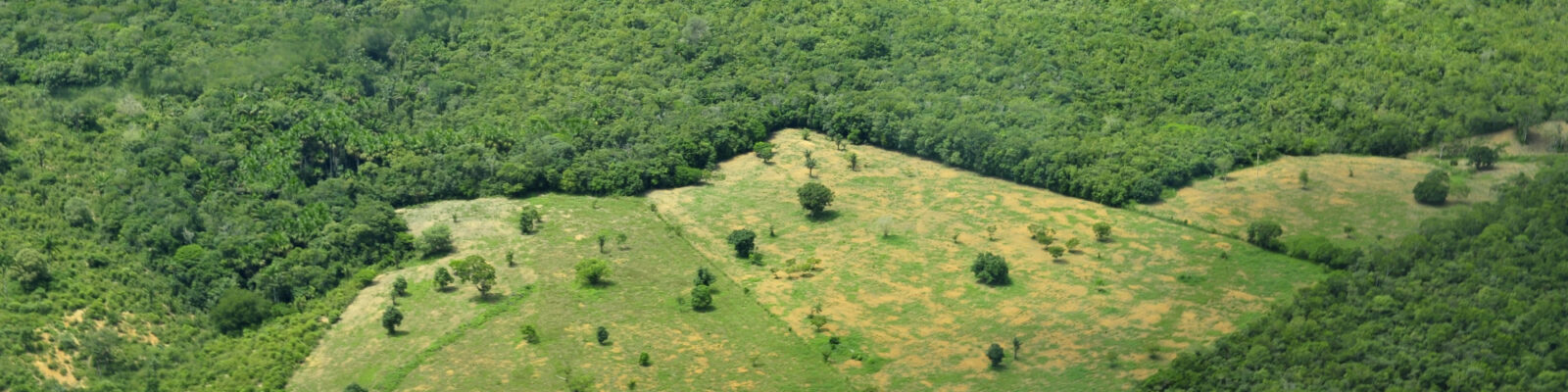
2) Footprints of Colonialism – by Linu Danielkutty (2024-2028) ![]()
A PhD project on “The Footprint of Colonialism: Attributing Biodiversity Loss and GHG Emissions from Colonial Land Change Processes”, started in 2024. This project will use HYDE (among other) data to quantify the consequences of past (colonial) land use changes in various former colonies of The Netherlands, and probably others as well. Quantifying the cumulative attribution of countries to biodiversity loss and greenhouse gas (GHG) emissions arising from land change is of critical importance to achieve global environmental justice. Attribution of individual countries to past land change in an objective manner gives clear information for negotiations around loss and damage finances, as recently debated at United Nations conference on climate Change (COP27) and biodiversity (COP15).
The aim of this project is to quantify the relative attribution of different countries to biodiversity loss and GHG emissions arising from land change since the colonial period using footprint analysis. This will illustrate to what extent the burden of resource extraction has shifted over time and how colonial legacies impact environmental footprints in present day. We will use an approach that integrates the HYDE database (https://landuse.sites.uu.nl/hyde-project/) of landcover change with reconstructions of resource flows based on historical data and footprint modeling techniques.
CLARiTy
CLARiTy (Combining LAnd-use, modeling and Remote-sensing to Transform carbon budgets), to be started in Fall 2025.
A large international team consisting of 10 institutions contributing to the Global Carbon Project has successfully gained a $10 million funding for 5 years called the CLARiTy project, funded by the Virtual Institute for the Carbon Cycle (VICC), part of Schmidt Sciences. To be started in Fall 2025.
Executive summary. The largest uncertainty in the global carbon (C) budget (GCB) is in emissions (ELUC) from land-use and land-cover change (LULCC), which has an uncertainty of approximately 60%. This is mainly because, until now, we have lacked the tools and data to quantify emissions from deforestation and degradation in the tropics with sufficient accuracy and temporal consistency, and to capture recent afforestation in many extratropical regions. The legacy of LULCC decisions today will impact the remaining carbon budget required to achieve climate targets in the coming decades. As a society, we also rely on the land ecosystems to take up around one-third of all anthropogenic CO2 emissions, i.e. the natural land carbon sink (SLAND), which is also highly uncertain at interannual to decadal timescales. In the Global Carbon Budget (GCB) annual report, ELUC and SLAND are estimated by Bookkeeping Models (BMs) and Dynamic Global Vegetation Models (DGVMs), respectively. The incompatibility in the application of these modeling methods presents a fundamental challenge to closing the GCB (i.e., zero Budget Imbalance, BIM). Better quantification and understanding of the complex carbon flows involved in the land carbon cycle is therefore paramount. GCB is the most comprehensive source of data and information about regional-to-global scale carbon fluxes; it is updated annually and published at the UNFCCC COP meetings every year; CLARiTy will reduce the persistently high land flux uncertainties by an order of magnitude. Achieving this goal will require a combination of new datasets, a deeper process-understanding, sophisticated models and an improved experimental design. We will transform the way we monitor LULCC, disturbance, vegetation structure, biomass and biomass change using newly available high-resolution Earth Observation (EO) products coupled with the latest methodological advances in AI and modeling.
Model Intercomparison Projects
PMIP Past2K
April 2025. Work has started to provide long-term historical population and land use input for the Past2K working group of the Paleoclimate Modelling Intercomparison Project. We intend to use HYDE version 3.5 which has just been created for the Global Carbon Budget 2025 (https://www.globalcarbonproject.org/)
CMIP – Spatial population data
February 2025. HYDE is also considered as input for the historical spatial population input as starting point for future spatial population scenarios in Coupled Model Intercomparison Project (CMIP), ScenarioMIP and ISIMIP.
LUMIP | Land Use Model Intercomparison Project
Human land-use activities have resulted in large changes to the biogeochemical and biophysical properties of the Earth’s surface, with resulting implications for climate. In the future, land-use activities are likely to expand and/or intensify further to meet growing demands for food, fiber, and energy. CMIP5 achieved a qualitative scientific advance in studying the effects of land-use on climate, for the first time explicitly accounting for the effects of global gridded land-use changes (past-future) in coupled carbon-climate model projections. Enabling this advance, the first consistent gridded land-use dataset (past-future) was developed, linking historical land-use data (provided by HYDE), to future projections from Integrated Assessment Models, in a standard format required by climate models. Results indicate that the effects of land-use on climate, while uncertain, are sufficiently large and complex to warrant an expanded activity focused on land-use for CMIP6. See https://www.cesm.ucar.edu/projects/CMIP6/LUMIP/.
HYDE
HYDE portal ![]()
End January 2024, we have launched a HYDE Portal, which will enable the user to browse, query and explore the rich HYDE data sets in an interactive manner. HYDE 3.4 was completed and used for Global Carbon Budget 2024 (Friedlingstein et al 2025)
HYDE database
November 2025. HYDE 3.5 is finished and available under Datasets. Radiocarbon archaeological data for Eurasia is implemented to update the onset and location of earliest settlements. MapBiomas data for Brazil, Indonesia and updated data for China are implemented.
June 2023. The HYDE version 3.3 is an updated and internally consistent combination of historical population estimates and also an implementation of improved allocation algorithms with time-dependent weighting maps for cropland and grassland, while the period covered is 10,000 BCE to 2023 CE. Continuous updating and elaboration of most recent satellite information, sa well as more historical and archaeological sources are in full progress. Version 3.3 has now included a distinction of grazing land into pasture, natural rangeland, and converted rangeland, as well irrigated and rainfed cropland areas and rice.
Version 3.4 will have a major revision of the grazing lands in Africa, new updated range of satellite information.
For more information see HYDE projects.
Network(s)
LANDCOVER6K working group
PAGES (Past Global Changes) supports research aimed at understanding the Earth’s past environment in order to make predictions for the future. Adequate incorporation of land cover in global and regional climate models is still one of the major priorities in the climate modeling community. In particular, anthropogenic land cover change (ALCC) is still not successfully implemented in these models. As a result, climate modeling in paleo-mode or projection mode that tries to take ALCC into account is seriously hampered (Strandberg et al., 2014).
This is due to the fact that:
i) the dynamic vegetation models coupled to global climate models (GCMs) or regional climate models (RCMs) simulate climate-induced vegetation (i.e. potential, natural vegetation) but cannot yet simulate anthropogenic vegetation, and
ii) the scenarios of past ALCC, e.g. HYDE (Klein Goldewijk et al., 2011; 2013), KK10 (Kaplan et al., 2010), and others, show very large differences (Gaillard et al., 2010).
The question of whether humans had more impact on climate in prehistory (from 3k BP or earlier) than previously assumed, is still a matter of debate. Thus, the effect of anthropogenic burning and deforestation on global climate via biogeochemical and bio-geophysical processes in the past is not fully understood yet, and mitigation strategies using e.g. tree plantations to create CO2 sinks and climate cooling might be erroneous. Improved descriptions of past anthropogenic land cover change at the global spatial scale are therefore needed.
LandCover6k will build on, and expand, the pollen-based reconstruction work of PAGES’ Focus 4 theme, Land Use and Cover. It will bring together paleo-ecologists, historians, archeologists, and modelers to explore and provide new information about ALCC. It aims to create products suitable for climate modelers and climate change policymakers. See https://pastglobalchanges.org/science/wg/former/landcover6k/intro
Global Carbon Project
The Global Carbon Project (GCP) was established in 2001 in recognition of the large scientific challenges and critical nature of the carbon cycle for Earth’s sustainability. The scientific goal of the project is to develop a complete picture of the global carbon cycle, including both its biophysical and human dimensions together with the interactions and feedbacks between them. HYDE provides yearly updates on the land-use part to LUMIP and the TRENDYconsortium, which is the international activity providing land flux estimates for the Global Carbon Project’s (GCP) annual carbon budget update. See https://www.globalcarbonproject.org/
ANTHROMES
The Anthromes Project aims to investigate, understand and model human transformation and management of the terrestrial biosphere based on the concept of Anthromes (Anthropogenic Biomes) as a new paradigm for incorporating human systems into global ecology and earth science research and education for the Anthropocene. Currently, we are working on the Anthropogenic Transformation of the Holocene and of the Future with prof. dr. Erle Ellis, Univ. of Baltimore, USA. (see http://ecotope.org/anthromes/).
A new and exciting research effort is now underway to investigate the role of Future Anthromes upon biodiversity and heat stress, against the light of the different Shared Socioeconomic Pathways (SSPs), as computed with the integrated assessment model framework IMAGE, a collaboration with the Netherlands Environmental Assessment Agency (PBL).
Past projects
CLIO-INFRA
In 2010, NWO awarded a subsidy to the Clio Infra project, lead by Prof. dr. Jan Luiten van Zanden of the International Institute of Social History (IISH). Under the title of Clio Infra, a set of interconnected databases has been set up containing worldwide data on social, economic, and institutional indicators for the past five centuries, with special attention to the past 200 years. These indicators allow research into the long-term development of worldwide economic growth and inequality.
Global inequality is one of the key problems of the contemporary world. Some countries have (recently) become wealthy, other countries have remained poor. New theoretical developments in economic science – such as new institutional economics, new economic geography, and new growth theory – and the rise of global economic and social history require such processes to be studied on a worldwide scale. The question of worldwide economic growth and inequality can only be researched on the basis of worldwide data concerning the patterns of economic performance and their causes. Clio Infra provides datasets for the most important indicators. Economic and social historians from around the world have been working together in thematic collaboratories, in order to collect and share their knowledge concerning the relevant indicators of economic performance and its causes. The collected data have been standardized, harmonized, and stored for future use. New indicators to study inequality have been developed. The datasets are accessible through the Clio Infra portal which also offers possibilities for visualization of the data (http://www.clio-infra.eu/)
The unique global datasets enable new opportunities for data analysis and the testing of hypotheses from new economic theories. Clio Infra offers the opportunity to greatly enhance our understanding of the origins, causes, and character of the process of global inequality.